The Night a Volcano Slid Into the Sea
An eruption and flank collapse at Anak Krakatau generated a tsunami on December 22, 2018. The disaster exposed a blind spot in warning systems built around earthquakes.
The 2018 Sunda Strait tsunami arrived without the large earthquake many people associate with tsunami warnings. A section of Anak Krakatau’s flank collapsed into the sea during an eruptive episode, displacing water and sending waves toward nearby coastlines.
This simplified diagram shows the process, not a surveyed inundation map. The tsunami affected coastlines around the Sunda Strait; impact varied with local shoreline shape and exposure.
See the event on the ground
Historical records show where effects were observed and what changed. These visuals are for context, not current hazard guidance.
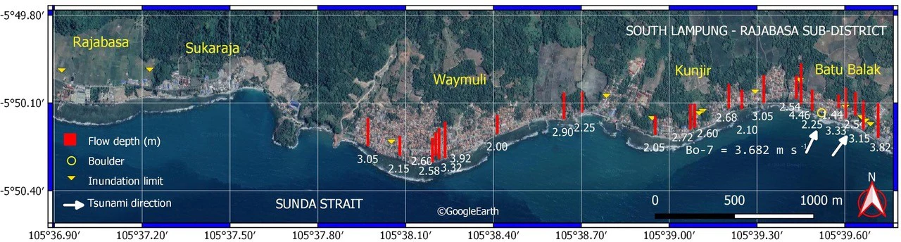
Researchers mapped flow depths and inundation limits in Rajabasa after the tsunami. This field-survey map records observed measurements, not a forecast or complete regional inundation boundary.
Swipe horizontally to explore the map.Syamsidik et al. (2020), Fig. 10; base imagery adapted from Google Earth · CC BY 4.0 ↗ · License details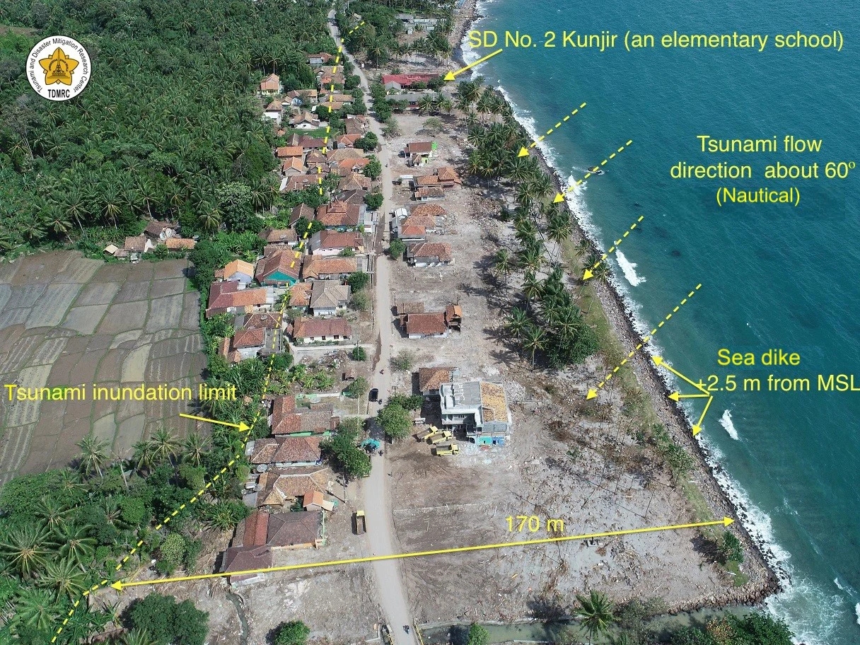
Aerial field photograph from the tsunami-affected village of Kunyir, captured during the research survey on December 31, 2018.
Tsunami and Disaster Mitigation Research Center field survey; Syamsidik et al. (2020), Fig. 11 · CC BY 4.0 ↗ · License detailsHow the episode unfolded
An eruptive phase begins
Anak Krakatau entered a period of renewed activity. Satellite images recorded ash and steam plumes over the Sunda Strait in the months before the tsunami.
Collapse at the island volcano
During ongoing eruptive activity, part of the volcano’s southwestern flank failed into the sea. Later analyses estimated the collapse volume at tens of millions of cubic meters.
Waves reach populated shores
The tsunami struck parts of Java and Sumatra. Because it was not preceded by a large earthquake, people had little of the familiar natural warning they might expect.
A difficult warning problem
Investigators combined seismic, satellite, tide-gauge, and eyewitness evidence to reconstruct the event and reassess monitoring needs for volcanic islands.
Why the warning was difficult
Many tsunami warning systems depend on detecting earthquakes and estimating whether the seafloor moved. A volcanic flank collapse is a different source: a landslide can displace water without a large tectonic earthquake.
The episode also demonstrates that a nearby volcano can create hazards beyond lava, ash, and gases. Coastal exposure, alert access, and rapid communication all shape the consequences.
A careful lesson, not a forecast
Researchers continue to study how best to detect and warn for landslide-generated tsunamis. No single sensor or historical episode can establish a reliable countdown for another collapse.
For immediate coastal safety, follow official Indonesian disaster-management and tsunami warning agencies. This retrospective is educational and is not a warning service.
Read the source records
Key claims and dates are linked to their original publishers. Impact totals can vary by reporting date and method.