The Morning the Mountain Unzipped
On May 18, 1980, an earthquake set a weakened north flank in motion. The landslide changed the volcano in seconds—and opened a new chapter in hazard science.
Mount St. Helens did not simply erupt upward. Its north flank failed first, unloading the pressurized volcanic system and directing a devastating blast across the landscape. The sequence matters: landslide, lateral blast, ash column, and lahars were connected hazards with different footprints.
This conceptual illustration is not a deposit map. USGS accounts show why “distance from the crater” alone can mislead: the blast was strongly directed north, while lahars followed river valleys.
See the event on the ground
Historical records show where effects were observed and what changed. These visuals are for context, not current hazard guidance.
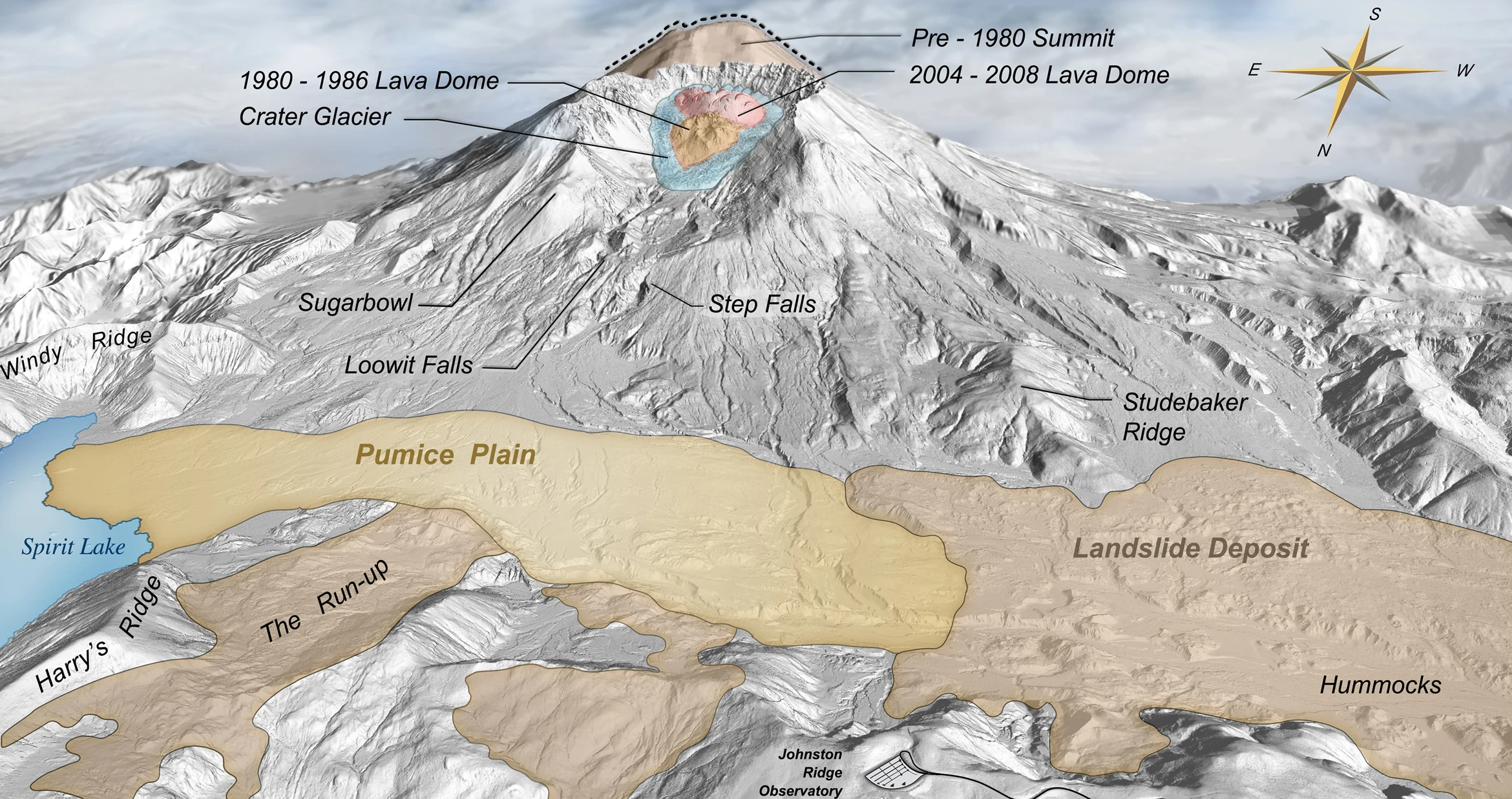
Lidar-derived shaded relief shows the crater and debris-avalanche deposits left by the 1980 eruption. It is a post-event terrain view, not a current hazard map.
Map: U.S. Geological Survey · Public domain ↗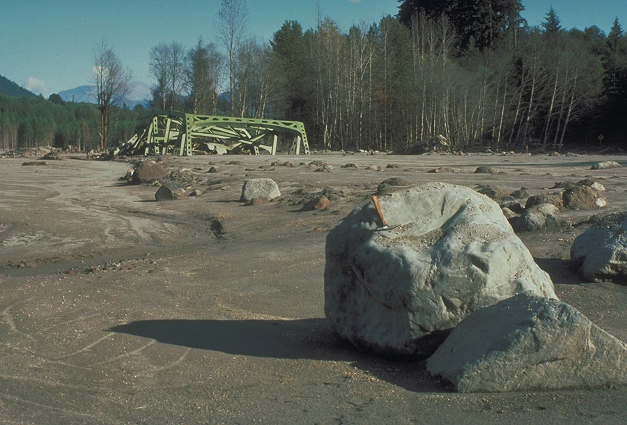
A bridge destroyed by the May 18 lahar in the North Fork Toutle River. The event sent sediment and water far downstream.
Photograph: Richard Waitt / USGS · Public domain ↗How the episode unfolded
Earthquakes begin
A sequence of earthquakes beneath the mountain signaled unrest. Steam-and-ash explosions followed, while magma moving into the edifice pushed the north flank outward.
A growing bulge
Repeated measurements documented rapid deformation on the north side. The bulge was a visible warning of change, but it did not make the precise failure time or extent certain.
The flank gives way
A magnitude 5.1 earthquake was followed by the largest recorded landslide at the time. Removing the overlying flank rapidly depressurized the system.
Blast, plume, and downstream flows
A lateral blast devastated the north sector. An eruption column rose, ash traveled downwind, and water-rich lahars moved through river valleys.
A hazard with direction
The northward blast flattened forest across roughly 230 square miles. Ridge lines and valleys shaped what was hit; the impact was not a neat circle around the summit. Lahars, meanwhile, traveled through drainages and carried sediment far downstream.
Fifty-seven people died. The losses included USGS geologist David Johnston, who was at an observation post north of the volcano. The toll and destruction made this the deadliest volcanic eruption in recorded U.S. history.
What changed in volcano science
The eruption showed how a landslide can rapidly change the behavior of a volcanic system. It also led to stronger monitoring, hazard mapping, and coordination between scientists, emergency managers, and the public.
The event is a case study, not a template for a future eruption. Every volcano has its own structure, history, population, and likely pathways; current official hazard maps and observatory notices matter more than analogy.
Read the source records
Key claims and dates are linked to their original publishers. Impact totals can vary by reporting date and method.