Semeru’s Deadly River of Ash and Debris
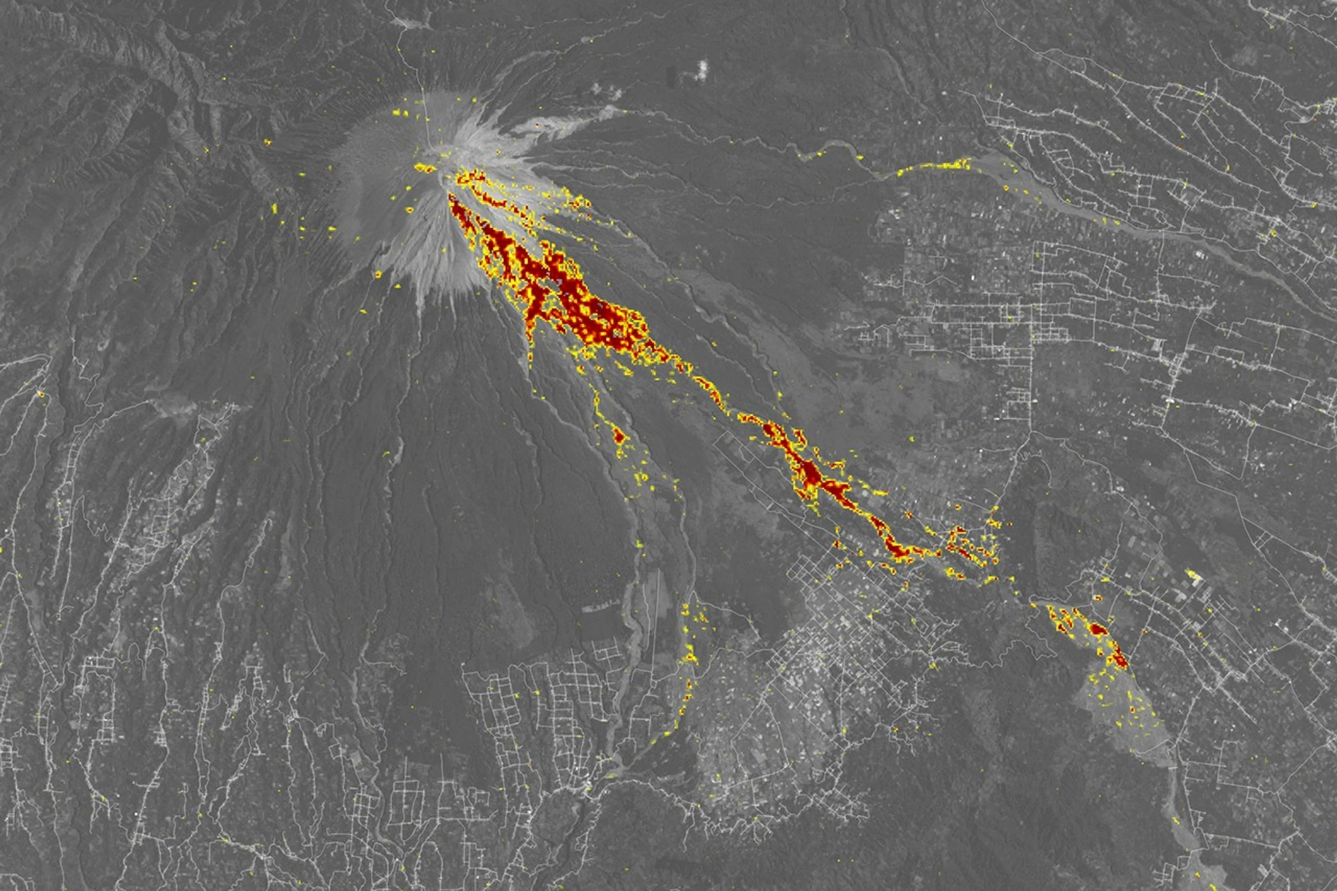
On December 4, 2021, hot volcanic flows and rain-remobilized sediment transformed valleys below Semeru. The danger did not stop when the plume faded.
Semeru’s December 2021 disaster was a sequence of connected hazards. Hot flows moved down valleys, while rain later mobilized loose volcanic sediment into destructive lahars. Communities near channels faced danger from material traveling far below the summit.
This is a process diagram, not a precise inundation map. Volcanic valleys channel flows; downstream risk can persist when rain remobilizes fresh deposits.
See the event on the ground
Historical records show where effects were observed and what changed. These visuals are for context, not current hazard guidance.
This damage-proxy map compares radar observations before and after the eruption. Colored pixels indicate likely surface change; they are not a surveyed boundary or a measure of individual building damage.
NASA Earth Observatory / ARIA; Sentinel-1 data processed by ESA and analyzed with Earth Observatory of Singapore · Landsat: USGS · OSM ↗How the episode unfolded
A hot ash cloud descends
The eruption generated pyroclastic density currents—fast, hot mixtures of ash, gas, and rock—that moved down Semeru’s slopes and valleys.
Rain and loose deposits compound danger
Rain interacting with fresh volcanic material contributed to lahars. These dense flows damaged settlements and infrastructure along river channels.
Rescue, recovery, and evacuation
Indonesia’s disaster agency reported 51 deaths and 10,395 displaced people as of December 21. These are dated response figures.
The channels remain important
Fresh deposits can be remobilized by later rainfall. Monitoring and local hazard planning therefore need to consider downstream valleys as well as the summit.
Why the danger traveled downstream
Pyroclastic density currents and lahars are different processes. A pyroclastic density current is hot and driven by gravity; a lahar is a water-rich flow of volcanic sediment that can occur during or after an eruption, including when rain remobilizes deposits.
Using the right names helps people understand why a quiet-looking crater does not mean every downstream hazard has ended. River channels can funnel material into areas well below the volcano.
People and place belong in the hazard story
The official Indonesian disaster agency documented deaths, displacement, and emergency response. Those figures are specific to the reporting date and should not be treated as a full measure of recovery or loss.
For current conditions, follow MAGMA Indonesia and local authorities. Do not use this historical case study to make travel or evacuation decisions.
Read the source records
Key claims and dates are linked to their original publishers. Impact totals can vary by reporting date and method.