
When Mauna Loa woke up
38 years since its last eruption. Two weeks of lava. A close look at what monitoring revealed, and what it could not.
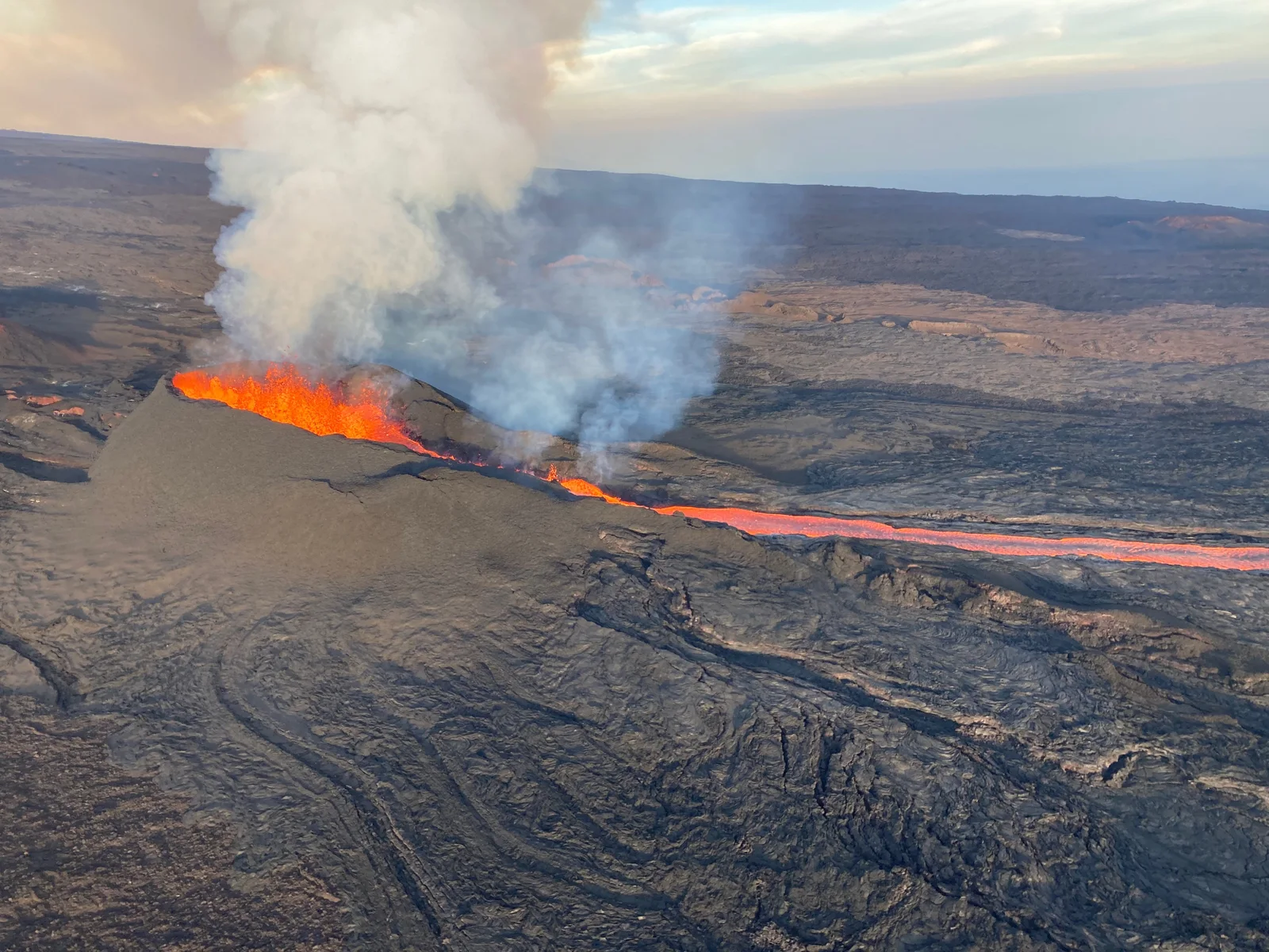
A road crossed. A highway spared.
The flow cut the Mauna Loa Observatory access road in its first day. It later stopped short of Saddle Road, the major route across Hawaiʻi Island.
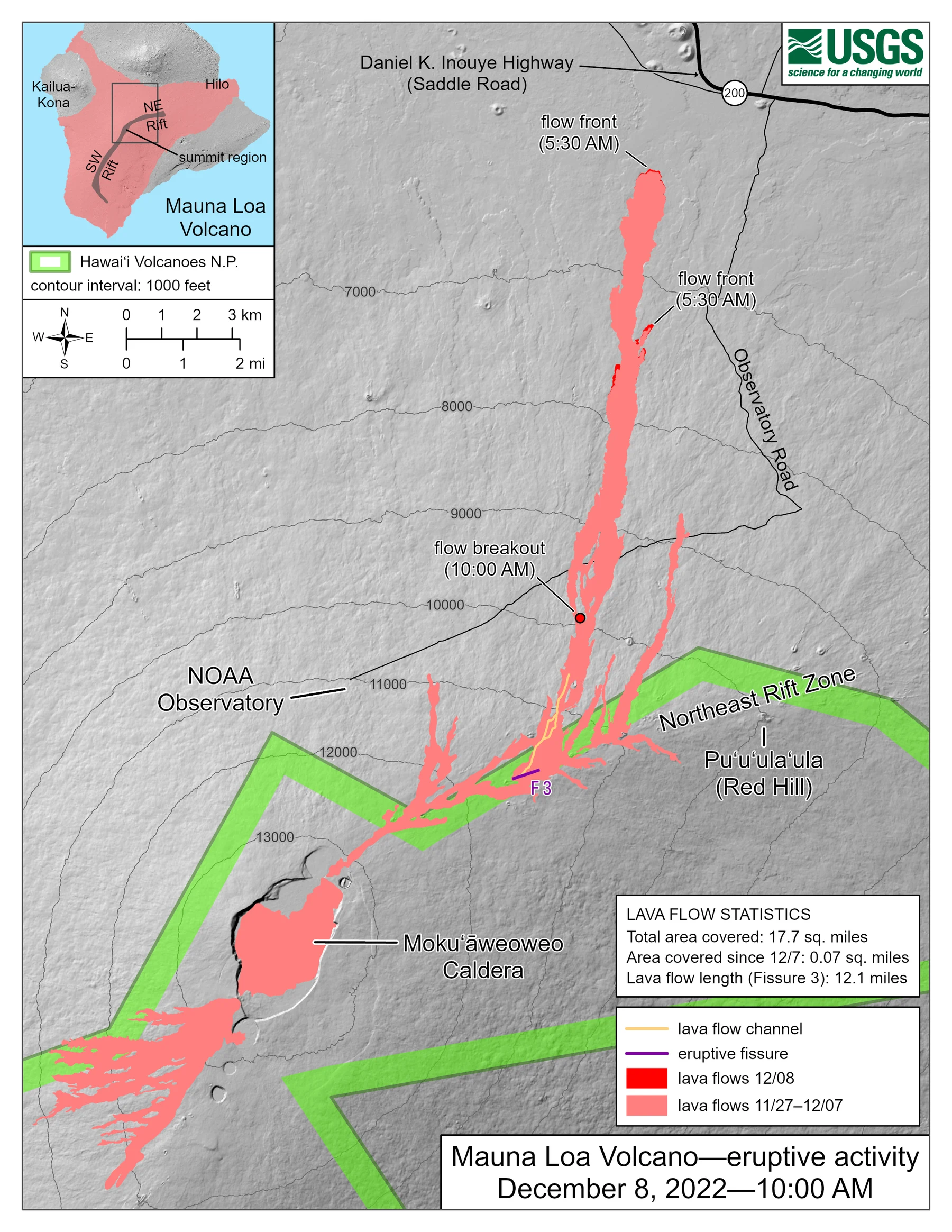
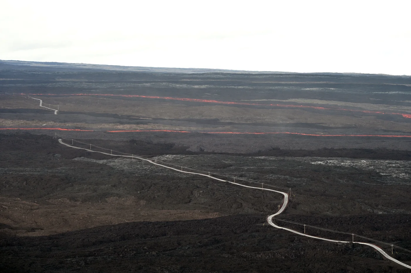
The map is a snapshot from December 8; flow fronts changed during the eruption. The final closest approach to Saddle Road was 2.8 km (1.7 miles), according to the USGS chronology.
Mauna Loa’s 2022 eruption began at the summit, then shifted to the Northeast Rift Zone overnight. That change is the heart of this story: monitoring is a process of combining evidence as a volcano changes, not reading a single instrument like a countdown clock.
From unrest to eruption
Read the sequence from top to bottom. Each observation added context; none, by itself, predicted the full outcome.
Follow the eruption as the evidence changed
Choose a dated milestone. The sketch marks the part of the volcano emphasized in that notice; it does not draw a lava map or predict the next step.
The summit erupts
After a short earthquake swarm and rapid summit inflation, an eruption began inside Mokuʻāweoweo, Mauna Loa’s summit caldera.
The original USGS chronology is linked in the source list below. Diagram locations are illustrative, not scaled or geographically precise.
What the instruments told us
Earthquakes
More frequent earthquakes showed increased activity. Counts alone cannot pinpoint an eruption’s start or vent.
Ground movement
GPS and tilt recorded inflation before the eruption and deflation during it. Scientists interpret those changes alongside other evidence.
Cameras + field work
Live webcams supported situational awareness. Field teams and mapping established details a distant camera could not resolve.
Gas + notices
Gas measurements helped assess waning activity. The official alert was an observatory assessment, separate from local emergency instructions.
What this episode cannot tell us
This is one historical example, not a template for predicting the next eruption. It establishes no universal earthquake or deformation threshold. The outcome depended on the vent location and local terrain.
For current conditions, follow the Hawaiian Volcano Observatory and local emergency authorities. MagmaAlert is an independent display of selected public data, not an observatory or official warning service.
Read the source records
This case study is based on original observatory reports and the USGS image archive.
- Full USGS eruption chronology
- HVO notice: eruption ended and alert level downgraded
- USGS account of monitoring before and during the eruption
- USGS camera-image data release
- USGS photo: Fissure 3 on December 7, 2022 (public domain)
- USGS: December 8 eruption map (public domain)
- USGS: lava cutting across the Observatory Road in two places (public domain)